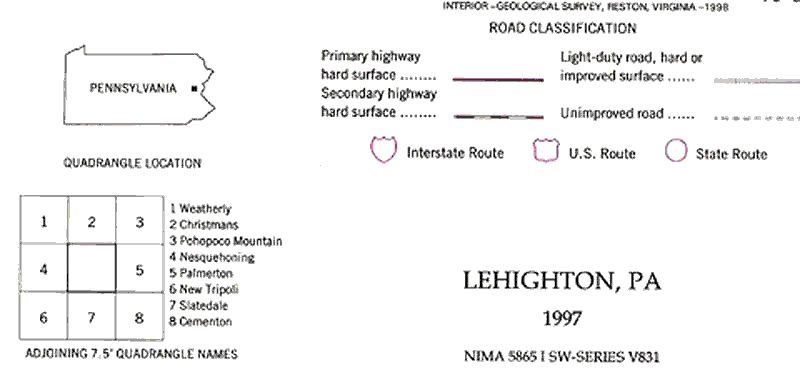
The legend on a topographic map is the set of instructions
for reading the map. Often maps will contain symbols and abbreviations
that will not be obvious to you. Just as you should always check the
scale, the legend will provide important information about what you
are looking at. The legend below is typical of what you may encounter
on a topographic map. The Pennsylvania outline on the left shows the
area of the state that the map represents. The checkerboard boxes below
the PA outline shows which maps surround this one.
Click on the map to see a larger image.
The following link will take you to the USGS site
with detailed descriptions of the symbols used on topographic maps.
USGS
Map symbols