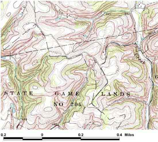
Take a look at the maps below. You may click on each thumbnail image
to view the map in greater detail.
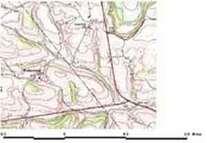
Each map has a different scale. Scale is the relationship between
distance on a map and the actual distance on the ground. The scale for
the map on the left indicates that a certain distance on the map, shown
by the dark line, is equal to 0.3 miles on the ground. The map on the
right shows that the distance between 0 and 0.4 miles on the map is
equal to 0.4 miles on the ground. Because the map on the right has a
smaller line representing a larger distance, the map covers a larger
area compared to the map on the left.
Often maps will show scale in a fraction or ratio. For instance, you
may see 1/20,000 inches. This means that for every one inch on the map
there are 20,000 inches on the ground. The first number or the map distance
is always 1. The second number, or the ground distance changes depending
on the map. As a rule, the larger the second number, the smaller the
scale.
When using a map, it is important to identify what the scale is for
that map. Knowing scale will allow you to determine distance. The distance
between two points on a map can be found by measuring with appropriate
scale.