40 41' 30 N
75 12' 26 W
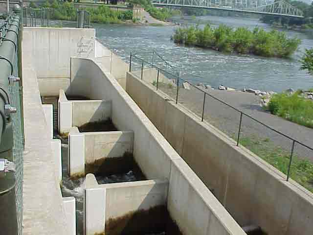
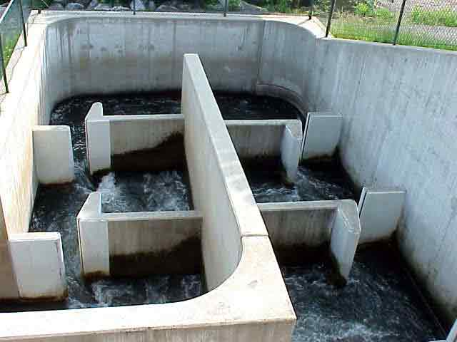
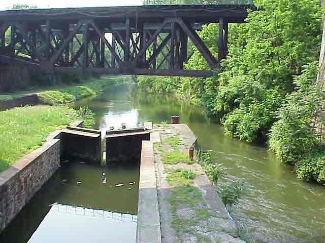
Fish ladders have been constructed in Easton, Glendon, and Allentown
to allow fish to reach their spawning grounds upstream. When dams are
constructed in the path of migration, fish are forced to find an alternate,
less suitable habitat for spawning. The survival rate for eggs and young
fish is negatively affected by forcing them to spawn elsewhere. Fish
ladders allow species to migrate upstream around the dam to find the
most suitable habitat for spawning.
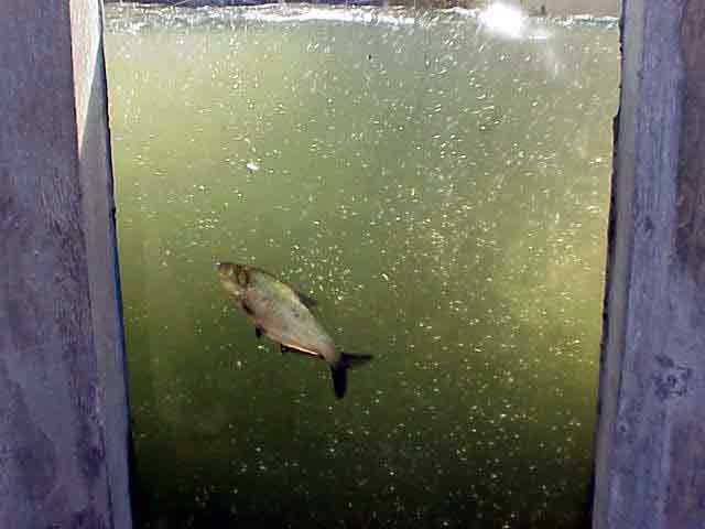
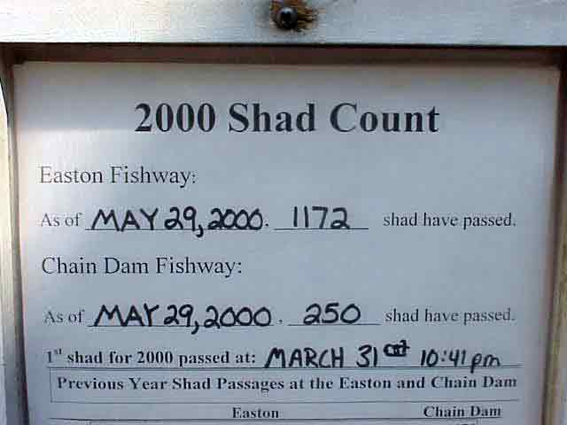
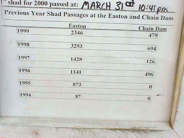
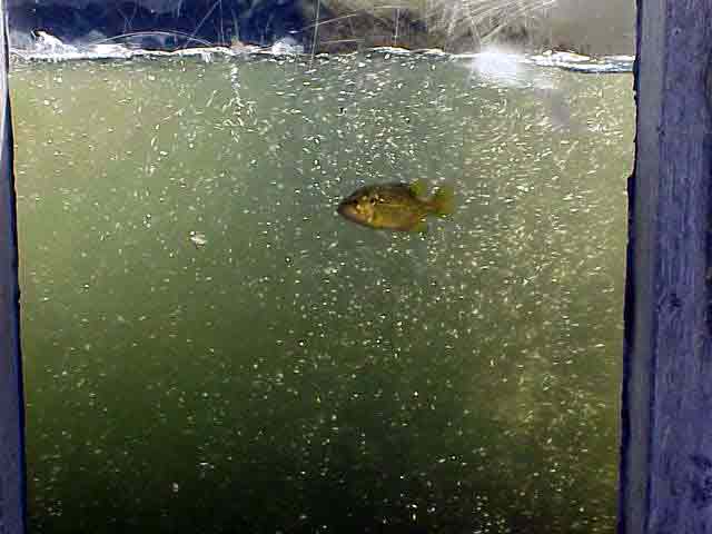
The fish ladder in Easton has a clear window where visitors and monitors
can view the fish that use the ladder to pass the dam. The shad population
at Easton has been on the rebound in recent years with the help of the
Fish and Boat Commission. Once they climb the fish ladder, the shad
have about 35 miles of river for spawning. Monitoring studies have shown
that the fish ladders are very effective in sustaining the shad population.
Fish ladders are not a new concept. They have been used in England
and Ireland since the 1800’s.
View in Google
Earth
 Panorama 1 (Taken at 40 41' 30 N, 75 12' 26 W) (596 K)
Click on a thumbnail photo to view a full screen image.